
Sight
Pamir
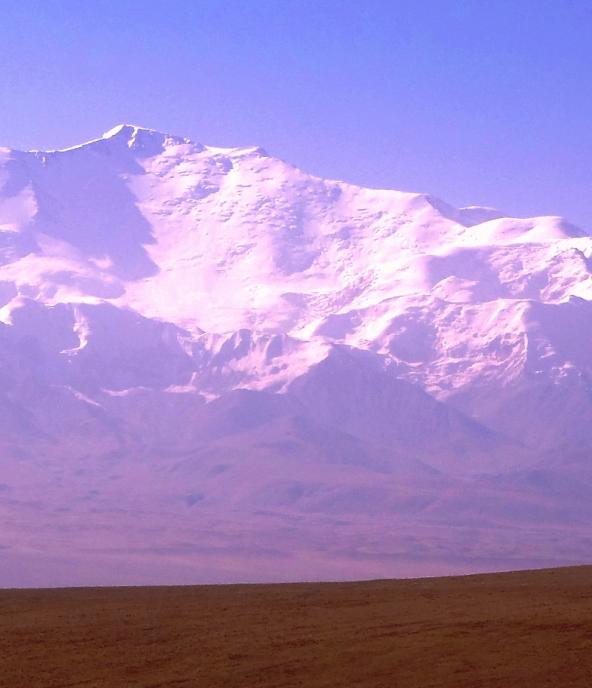
Gorno-Badakhshan • Tajikistan • 7000 m
The Pamir range is located in the Northern Central Asia, it lies mostly in the Gorno-Badakhshan province of Tajikistan to the North it joins the Tian Shan mountains along the Alay Valley of Kyrgyzstan and to the south it borders with Hindu Kush mountains along Afghanistan's Wakhan Corridor and with the east Chinese Muztagh. The word Pamir translated as "the roof of the world".
In the 18-20th centuries, the Pamir range and the surrounding area were the scene of geopolitical rivalry of the British and Russian empires, called the "Great Game". The military department of the Russian Empire concerned about the activity of the British near the Pamir mountains, and decided to build a strategic military road: The construction was planned and carried out in deep secrecy and for a long time the existence of a wheel road in the Pamirs in Russian Turkestan in Europe unknown. After the construction of the Pamir tract, the wheel road in 1894 was named the Old Pamir Trakt. With the completion in 1937 of the construction of a highway connecting Osh and Khorog.
Pamir is divided into two natural and climatic conditions, the Eastern and Western Pamirs. In the Eastern part, the climate here is sharply continental, severe. This part of the Pamirs is characterized by the desert air dryness and, almost icy constant winds, often reaching the strength of the hurricane. Summer sun burns the skin, and in the shade while it's cold. The population of this region, live almost exclusively in cattle breeding and are engaged in breeding sheep and yaks, as well as hunting for mountain sheep (argali). It should be noted that argali are a kind of symbol of the Eastern Pamirs, and their horns are its emblem. On the Western Pamir winter here is mild, summers are warm. Here the Pamiris are engaged in agriculture and cattle breeding.